
Deba to Markina
Distance Covered: 15 miles / 24.3 km
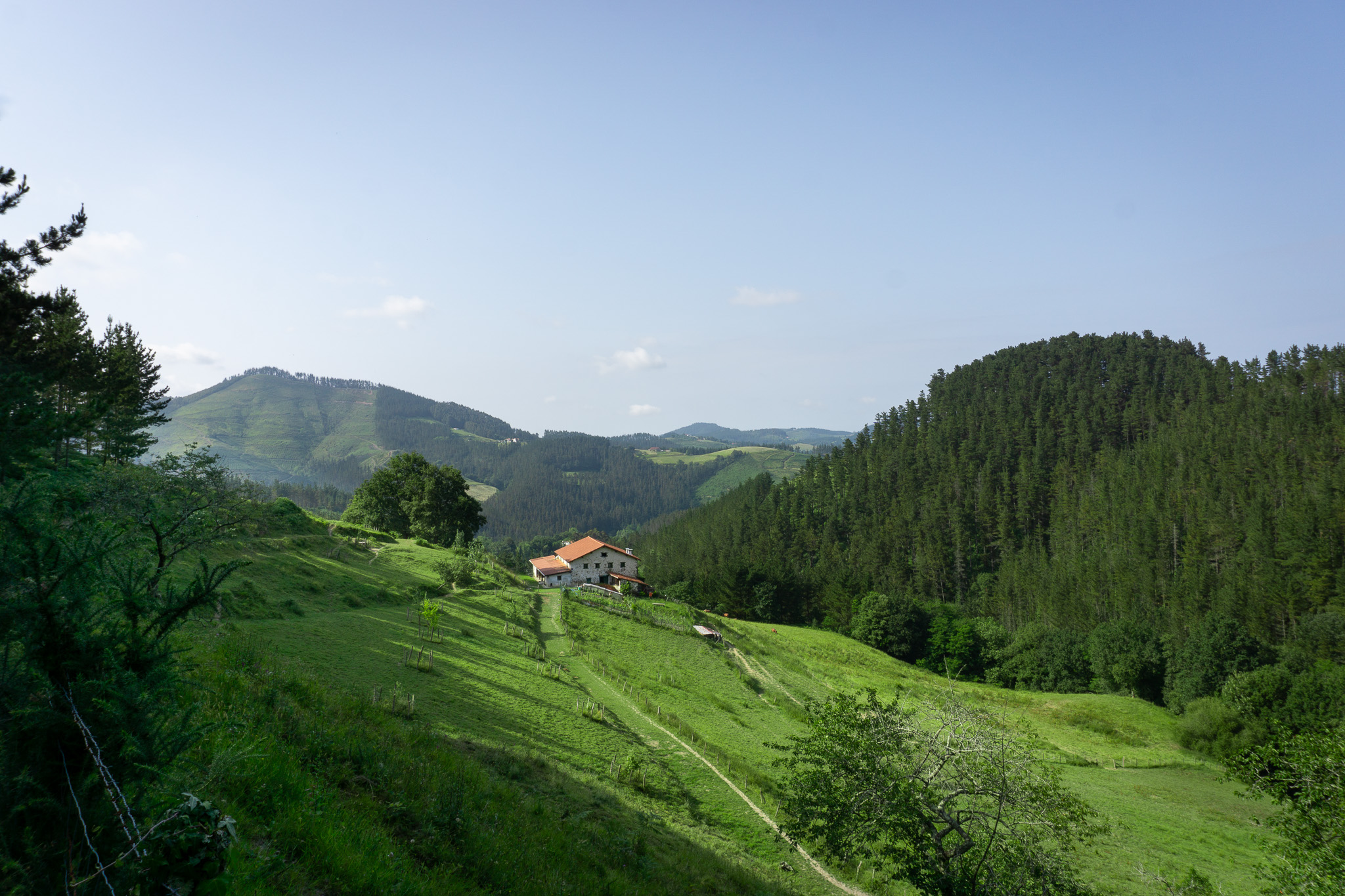
This stage of the Camino del Norte veers inland away from the coast, passing through small mountain villages, and providing beautiful views of the Basque countryside. This section has a significant amount of climbing but nothing too technical.
Much of the route passed through a mix of farmland, mountain trails, and forest roads. Aside from beautiful forest scenery I also came across a small dog who guided me through some of the trickier unmarked sections of trail. Though it was another long day, I had nearly perfect weather conditions and the scenery made for a pleasant hike.
If this is the first post you’re reading and want to start from the beginning, check out my Camino del Norte page, which features all of my Camino posts in chronological order. If you want to learn more about the Camino de Santiago itself, check out my post breaking down the basics of the Camino de Santiago.
Setting out from Deba
After the long day of hiking from Zarautz to Deba, I slept like a rock. I was the very last person in the albergue to wake up, and made it out the door at around 8:45. Just waking up and still adjusting to the weight of my pack, I slipped down a step on the steep staircase on my way out of the albergue, and scared the cleaning woman who was just arriving half to death. The little old woman did a quick sign of the cross motion and asked if I was okay, and I assured her that everything was fine.
After narrowly avoiding rolling an ankle before I had even had a sip of coffee, I counted my lucky stars and made a bee-line for the nearest café. I wandered to the center of town where I found the German and English girls I had met the night before having breakfast out on a terrace. After chatting for a few minutes, I went inside to get a coffee and something to eat, and had breakfast with the girls out on the patio. Not wanting to delay my day much longer, I ate quickly, said my goodbyes, and was on my way.
The hike was full of steep climbs, taking me up to a ridge line only to lead me right back down towards the coast again an hour later. I trudged along like this for a few hours which made for a pleasant though strenuous morning.

Wandering off trail
After a few hours of walking, I had just come to the top of yet another hill climb, and sat down to eat a quick snack and catch my breath.
Two old men, probably in their late 70s, walked by where I was sitting, and I asked them if I was headed the right way since I hadn’t seen a sign marker in a while. They said I was, but balked at the idea of walking all the way back down to the coast only to come right back up again. They told me they knew a more direct route through the mountains that would save me some steep climbs.
Naturally skeptical of veering too far off the marked path, I listened and nodded politely but wasn’t sure that I’d take their route. As a pilgrim planning to just follow the markings, it didn’t seem like the best idea to be wandering off path just a few days into my trip. But after looking at Google Maps for a while once they left, I figured I would give their shortcut a go, as I could mostly see where the route they described went. In the worst case I could backtrack if I needed to, and with that I left the well-marked Camino trail behind.
I walked for around 20 minutes through a steep forest trail before coming across a small, stray dog. Fortunately I had trekking poles with me that made me feel comfortable around him, since without them stray dogs can be a real danger in rural Spain.


After being bitten by a dog in Russia back in 2013, I was a little leery of foreign dogs in general, but this one showed no signs of aggression and genuinely seemed to just want to walk with me. I tried several times to wait for him to walk ahead, or to speed past him, and he would either run to catch up, or stop and wait for me. With my new buddy leading the way, I eventually made it through the labyrinth of mountain trails.
Interestingly enough, there were several turns that I could have taken, and he consistently went ahead of me and took the path that would eventually lead me back to the well-marked Camino trail. Unfortunately I didn’t have any snacks that would interest a dog, so once I was back to a road I gave him a nod, and he watched me walk away down the road.
Quick lunch in a small town
Back on the Camino trail, I happened upon a small town that had a little restaurant, but their kitchen was closed when I showed up. They were actually about to close down for a few hours, but the owner sold me the few pieces of food (txistorra, chorizo, and a pile of croquetas) that she had left of the counter along with a cup of coffee. She sent me out to the patio with my food and locked up and went home, telling me to leave everything there when I was done.


Enjoying the little break from walking, I kicked my boots off and happily ate the greasy bar food. With all of the miles that I was walking, plus the heavy pack I carried, I was actually finding it difficult to eat enough calories to maintain my weight.
Hiking deeper into the mountains

Reunited with the official Camino trail, I headed away from the coast and into the mountains, following rural farm roads. The hiking was pleasant, and followed mostly gravel roads up into the mountains with very little car traffic. After stopping to take some pictures, I tried to walk a little quicker to put some miles behind me and focus on climbing the steep hills.

Most of the afternoon I only saw a few farmers and really did not see many other pilgrims. I think because of the reroute that I took, I was out of sync with the rhythm of most other pilgrims hiking that day.
The hills started to get steeper and steeper, and I eventually came to a junction of roads that was not very clearly labeled. After a few weeks on the Camino I became hyper-aware of even the slightest hint of yellow spray paint or arrow signs, but at this point I guess I just wasn’t tuned in enough. I unfortunately chose incorrectly, and wound up hiking a mile or two off route up an incredibly steep hill before I noticed something was off.


After realizing this, and then discovering that I would have to backtrack all the way back down and then once again climb up the steep hill, I was not exactly excited. I slowly made my way back down, and this time went up the correct hill, double checking my route.
Near the top of the long climb, I met my first few Americans hiking the Camino, a young married couple from the West Coast. They had also made a wrong turn earlier and were having a rough day with all of the climbing. I was glad to have the company of some other pilgrims, and they were excited to meet someone they could speak English with.


I don’t have many pictures from this section because we got caught up in a conversation about how we ended up doing this hike and how long we expected it would take us. We chatted as we walked, but we were all thoroughly exhausted by this point.
Finally arriving to Markina, they splurged on a private hotel room, and I kept walking to find a cheap bed in an albergue público located in an old local church. I had a very long way to walk to Santiago, and I had to make sure that my money would last.
I eventually found the albergue that I had read about in Markina, and secured a bed in a large, shared dorm that only cost me five euros for the night. Let me tell you, I would have paid much, much more just for the privilege of taking a hot shower after the long day that I had.
I ate a quick sandwich for dinner and went to bed early this night, hoping to recover a bit from the long day. They offered a simple breakfast (coffee and toast with marmalade) at 6:30 A.M., so I figured I would do my best to be up by then.
Route details
For a detailed route description, take a look at the map on Gronze.com. On this website there is a route map and a comprehensive list of the places to stay along this section with rough price guides. The red and green bars signify the distance from the Camino route, each with a rough distance estimate.
The private albergues and hotels allow for booking ahead of time, while the donation-based albergues (marked with a D for donativo) are all first come, first served. The amenities are basic, but it’s by far the most affordable way to walk a Camino.
If you’re interested in reading the detailed route description, you’ll have to translate the page from Spanish to English, which you can do using the three vertical dots in the upper right.
Final thoughts
This day was a great example of the things that can go very right and very wrong when improvising on the Camino; local strangers suggested a much better and more scenic way to avoid some hill climbs, and then missing a turn and adding a few hundred extra feet in elevation gain to the day’s hiking.
I made the decision to complete the Camino without downloading any navigation apps, and I was sticking to it. In the end, I made it to Santiago only using signposts and snapshots of map sections, and I’m glad I did it that way. There are a number of GPX maps and apps you can download and follow, but the trail is pretty well-marked. I found that not depending on an app allowed me to be more present for the experience and focus more on taking photos and talking to other pilgrims.
While it was a big physical challenge, the people (and the dog, of course) that I met out on the trail helped keep my spirits high. Really everyone that I spoke with had a great attitude about the hill climbs, and they were just happy to be out there.
If you’re looking for Camino inspiration, subscribe to get notified whenever I post new articles. And if you’ve hiked this section before, did you find it as difficult as I did? Let me know down in the comments. And as always, ¡Buen Camino!
Subscribe!
Enter your email below to receive updates on the latest posts.
Leave a Reply